-
Please be sure to read the rules and adhere to them. Some banned members have complained that they are not spammers. But they spammed us. Some even tried to redirect our members to other forums. Duh. Be smart. Read the rules and adhere to them and we will all get along just fine. Cheers. :beer: Link to the rules: https://www.forumsforums.com/threads/forum-rules-info.2974/
You are using an out of date browser. It may not display this or other websites correctly.
You should upgrade or use an alternative browser.
You should upgrade or use an alternative browser.
21 Days North of the Arctic Circle
- Thread starter Lyndon
- Start date
NorthernRedneck
Well-known member
Yikes! That thing is big! (I know, I know....my wife said the same thing on our second date)
Anyways, that is one huge moose! Thanks for sharing.
Anyways, that is one huge moose! Thanks for sharing.
mattfidaho
Member
Yikes! That thing is big! (I know, I know....my wife said the same thing on our second date)
Anyways, that is one huge moose! Thanks for sharing.
I would have thought the beer gut size would have came up on the first date.
Have him go walk up next to it so we have a size to compare to.
Lyndon
Bronze Member
-1 Deg F, -20 W/windchill. snowing and blowing. Through out this thread I showed stuff about Doyan Rig 14, it drilling, it being knocked down and rolling out of Milne Pt., pictures of it's camp and support modules, all headed to Bedami. Also on post # 328 I showed a group of rolligons. The far left hand machine with the Tank. Well Discovery Channel just released a documentary that starts out where I left off. Aparently I took the pictures while they were at dinner. there are shots of the rig camp and the sea ice road construction, and the entire trip that the rolligon made to refule some remote aircraft depot. Things are alot more laid back and routine than they try to make it sound. Of course they are trying to get shock effect. For the rolligons they make it sound like it's life on the line, when in reality, we have a dozen helicopters, 20 more rolligons, and over 100 snow cats that could rescue them in 20 minutes. See it, you'll like it! now on to:THE CONDORS NEST
Lyndon
Bronze Member
THE CONDORS NEST
Condors are the largest flying birds in the northern hemisphere according to wikipedia.

But that's not what were looking for. Remember, this is a 'Snow Cat' forum. when I first started working up here, I once saw a rather unique tundra capable bucket truck servicing some power lines. I took a few photos with a 35 MM camera, but it didn't have a telephoto lense. When I went to develop the pictures, it was but a dot on the landscape. For some years I kept my eye out for it. But specialty equipment of this nature usually get's housed inside. the Prudhoe oilfield is 558 sq miles, making it the largest oilfield in North America. Kuparuk, at 200 Sq. Mi. holds second place. There are 7 others of smaller size, such as Milne, which only covers 94 Sq.Mi. The total area is something closer to 1000 Square Miles, and the elusive Condor could live in any of hundreds of buildings spread across the vast area.
Condors are the largest flying birds in the northern hemisphere according to wikipedia.

But that's not what were looking for. Remember, this is a 'Snow Cat' forum. when I first started working up here, I once saw a rather unique tundra capable bucket truck servicing some power lines. I took a few photos with a 35 MM camera, but it didn't have a telephoto lense. When I went to develop the pictures, it was but a dot on the landscape. For some years I kept my eye out for it. But specialty equipment of this nature usually get's housed inside. the Prudhoe oilfield is 558 sq miles, making it the largest oilfield in North America. Kuparuk, at 200 Sq. Mi. holds second place. There are 7 others of smaller size, such as Milne, which only covers 94 Sq.Mi. The total area is something closer to 1000 Square Miles, and the elusive Condor could live in any of hundreds of buildings spread across the vast area.
Lyndon
Bronze Member
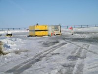
So first chance that I had some ligimate business over that way I stopped by "Twin Towers", and located the Condors Nest. The lettering was old and faded, years of 70MPH snow storms had all but sandblasted the name off the building. it was -38 out, -60 with the windchill when I took these pictures.


This is one of the few places that the power crosses over a road. Everywhere else it goes underground. This is so that large loads such as Oil Drill Rigs can pass.
Now I've found it! What? It's not there, drat! some old water tanker was parked in it's place!


This is one of the few places that the power crosses over a road. Everywhere else it goes underground. This is so that large loads such as Oil Drill Rigs can pass.
Now I've found it! What? It's not there, drat! some old water tanker was parked in it's place!
Lyndon
Bronze Member
I did some upgrading of the fire detection systems at CPS many years earlier, I'll just go there and ask. The lineman are just finishing up a safety meeting and point me to the correct building complex some miles away.
Found em!
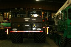
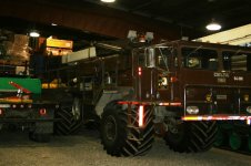
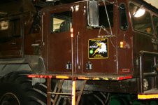
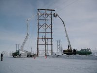
This Delta 3 Condor is a 6 By 6 with tundra tires, and has a 90 foot reach. taking pictures inside didn't do it justice. As always, with Prudhoe, it's a "crew-cab".
Found em!


This Delta 3 Condor is a 6 By 6 with tundra tires, and has a 90 foot reach. taking pictures inside didn't do it justice. As always, with Prudhoe, it's a "crew-cab".
Lyndon
Bronze Member
Somehow I remembered it as being bigger, but it had been a long tome since I originally saw it, and then it was at a distance. Today one of the lineman told me: "Oh, you mean the BIG Condor, it's over in bulding such and such".
I've been it the electrical trade some 30 years, and have worked out of 120' baskets alot, but this machine is certainly one of the largest I have ever seen. It has a 170 Foot "Stick". Enjoy.


I've been it the electrical trade some 30 years, and have worked out of 120' baskets alot, but this machine is certainly one of the largest I have ever seen. It has a 170 Foot "Stick". Enjoy.


More great stuff - thanks! 

mattfidaho
Member
WOW once again,
I don't think I would want to be in one of the buckets when any type of wind starts up LOL
I don't think I would want to be in one of the buckets when any type of wind starts up LOL
Lyndon
Bronze Member
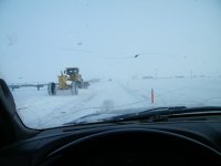
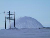
PREPARING A BRIDGE FOR THE SPRING SNOW MELT What they are doing here is plowing out all of this past winters snow from under a bridge crossing. the actual snow melt is still quite a ways off. We will still likely get several more snow storms, and some further drifting, so often all this work has to be redone.




Snowcat Operations
Active member
Yikes! That thing is big! (I know, I know....my wife said the same thing on our second date)
Anyways, that is one huge moose! Thanks for sharing.
Thats funny she said the same thing to me on our first date!
Snowcat Operations
Active member
BIGGER IN ALASKA?
One of my fellow inspectors, up here in Prudho, just bought an ST4 and joined the Forumsforum. He just e-mailed me these photos. Check out this Moose. He's REAL, not air brushed in or photo shoped.
View attachment 34632
View attachment 34633
Man that things as big as a moose!
Thats funny she said the same thing to me on our first date!
You guys had to date her?
Lyndon
Bronze Member
A bucket truck with tracks !!!
Thanks for the great pictures !
Are they digging out the snow because the spring run off is dramatic ? I mean; does it melt quickly or flood much ? Or is there just a build up of snow under the bridge from plowing ?
Yes, as this is one of those rare spots in the world where the rivers run from the south to the north, they tend to melt first in the south, then come flooding thru, north to the sea. Generally the flooding only last one to three days. It often reaches the sea when the sea is still frozen, and turns the sea ice black. The snow drifted in under the bridge from our frequent "Blows" that we get.
Lyndon
Bronze Member
The Electricians,(MY Electricians!), installing a new VFD(Variable Frequency Drive). It runs a down hole pump, probably about 600 HP. Things may be slow in the job market, but were still here shipping the gas and oil that runs a percentage of the nation untill they come up with a better alternative.


Lyndon
Bronze Member
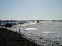
This location, where the previous 3 pictures was taken, juts out in the Beaufort Sea, or arctic ocean, and is surrounded on 3 sides by the ocean.
I'm going up to this pipe rack and get a couple picts:OH yes, that's WATER & Snow Melt, not oil below the walkway.

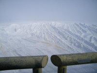
Looking at the REAL North Pole, across the sea ice. The Sea Ice starts just 20 feet past the road bed.

Olicktoc Point some miles across the ocean, an Oil Facility and a DEW Line Station, part of the Civil defense early warning system. Looking West.

Looking East 'Thru the Waterfall', toward Prudhoe bay. This shot is also looking across the ocean.

I'm going up to this pipe rack and get a couple picts:OH yes, that's WATER & Snow Melt, not oil below the walkway.

Looking at the REAL North Pole, across the sea ice. The Sea Ice starts just 20 feet past the road bed.

Olicktoc Point some miles across the ocean, an Oil Facility and a DEW Line Station, part of the Civil defense early warning system. Looking West.

Looking East 'Thru the Waterfall', toward Prudhoe bay. This shot is also looking across the ocean.


![mime-attachment[1].jpeg mime-attachment[1].jpeg](https://www.forumsforums.com/data/attachments/17/17198-e04391e843d3b043be2be3aa31cdfd39.jpg?hash=4EOR6EPTsE)
![mime-attachment[2].jpeg mime-attachment[2].jpeg](https://www.forumsforums.com/data/attachments/17/17209-c1183228fcdfe434739a9c44f7183990.jpg?hash=wRgyKPzf5D)


